Saturday 27 August 2011

Scoops Reports 2011 - 27 August 2011 Cairnsmore of Casphairn


Wigtownshire Ramblers 27 August 2011 Cairnsmore of Casphairn


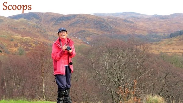
Cath, Frances, Thomas, Isobel, Rachel, Florence, Jacqui, Linda, Leslie, Jack, Shona, Elizabeth (Derek’s ‘The Alps’ wife), Paul, Sue, Colette (not seen her for ages!) and Brian, who was leading, met in NS.  We drove in convoy through New Galloway and St. John’s Town of Dalry and Carsphairn, turning off onto the B729 soon afterwards and being joined by Gordon who had come from a different direction.  We came onto a minor road and parked close to Craigengillan where the farmer came out to talk to us.  We thought he was going to move us on but he said that the logging had finished in the area and we were OK to park there.  He advised us to take the track up through the forest but Brian had other ideas! 
Meeting up at Craigengillan on Saturday morning, seventeen ramblers prepared for a long day in the hills, climbing Benniner and Cairnsmore of Carsphairn. The weather looked fair but storm clouds were never far away and the temperature was alternately warm and cold as the sun went in and out of the clouds.

The walk began at the shepherds cottage, across the road from which are the ruins of a mediaeval village, showing how this lonely place was once a thriving and populated area. The forestry has recently finished clearing sections of land here, and the roads were clear of logging traffic, allowing the walkers to keep up a good pace until reaching a ruined bridge where the track to Moorbrock became obscured. A boggy crossing of tussocks and sphagnum moss led to the old home of Tammas Murray, the shepherd poet, who occupied Moorbrock some time ago. The story of another shepherd who became ill was related; he was operated on in the house, and then needed fourteen men to relay him, on an improvised stretcher, to the road end at Craigengillan to meet the ambulance. The house and steading are now neatly kept holiday homes.

A new forest road continued through a water splash and wound round below Green Hill, passing by high deer stalking platforms. The route then took to the rough ground between trees and across the Poldores burn. Faint motor bike tracks were followed through the grassy and not too boggy skirts of the first objective, Beninner (710m). The easy part of the day was now replaced with a near vertical ascent of the hill, between screes, hanging on to grassy tufts and bare rock with hand and foot, whilst contending with the only shower of the day. The view below as the climb proceeded was dizzying; the ground fell away revealing the great expanse of desolate pastures contained beneath these hills.

Once on the rock strewn high plateau the going was easy and a short walk to the summit cairn was achieved with great relief. (However, for those of us who were trailing the relief was short lived as we only had a short stop before trying, in vain, to catch up with the others!) Two of the Striding Arches of Andy Goldsworthy were visible in the distance. These are a challenging subject for a future walk – erected in 2005, they form a series of red sandstone arches each with a span of about seven metres, built on the hilltops around Cairnhead.

A fresh breez e meant that the summit of Beninner was forsaken and a late lunch was eaten in the lee of the hill above the Nick of the Lochans. From here it was a stroll down to a boundary fence and up onto the top of Cairnsmore of Carsphairn (797m). A big cairn, separated by a few yards from a shelter, with the Ordinance Survey pillar, complete with its flush bracket, was the high point of the day. The views were phenomenal. From the Rhins of the Kells, the Awful Hand of the Merrick, Ailsa Craig and the sea, the lochs of Macaterick, Riecawr, Bradan and Doon, Ayr town, then the windmills around the well named Windy Standard, to the Moniaive hills and even across the Solway to Skiddaw; it was a 360 degree panorama.
Gordon took over from here for a while, taking us away from the summit, down a lovely slope for a while and then the going got really dreadful!  We slithered down over long grass and heather, had to watch out for holes beside large rocks and took ages getting down to another awful section.  This was over boggy, tussocky grass, for a long time, until we reached the Polifferie Burn and waited for others to catch up.  We followed the burn for a while, crossed it and then made our way to have a look at Clennoch Bothy for which we had made a huge detour.*

A ridge walk, followed by a very steep descent, then again through bogs, tussocks and deep, black peat, booby traps, to the Bow burn, led to the tidy bothy of Clennoch and a well earned rest whilst the building was explored.

Near this spot is the crash site of a local man, David Hunter Blair, who flew a spitfire into this remote hillside in May 1942. His plane was named ‘Blue Peter’ after a Derby winner. The children’s programme of the same name sent their presenter, John Lesley, here to record the event in 1997, and the Dumfries and Galloway Aviation group conducted a search of the area to find the crash remains. There is now a memorial plaque affixed to a boulder marking the site.

It was now a short walk to a new forest road, not yet on the maps, which was followed, up and down hill, until once more the cars were reached by the weary group.  The challenge of the long walk had been appreciated by all.

This meant we had a four mile trudge along the forest road back to the cars – going eventually passed Moorcroft holiday cottages where we stopped for a short break to drink some water – many of the walkers had gone on ahead.  We managed to avoid the worst of the boggy area through which we had gone towards the start of the walk and then I had to stop to put a blister plaster on my big toe before I could face the rest of the hard surfaced track to the end of the walk.  We arrived at 6pm, almost half an hour after most of the other walkers!


Saturday 20 August 2011

Scoops Reports 2011 - 20 August Stinchar Bridge Circular


Wigtownshire Ramblers 20 August Stinchar Bridge Circular


 Jim’s photo Cow Craig


A hired minibus brought the majority of today's walkers to the walk start at Stinchar Bridge. Guest walkers from Ayrshire and one from Stirling made the numbers up to twenty three. Duncan valiantly drove the minibus which initially carried Elaine, Frances, Isobel, Irene, Allan, Peter, John, Audrey, Jacqui, Susan and Pam (who lives the other side of Glasgow but who comes to Stranraer every third weekend).  When we set off I was sitting next to the window but found that I was sitting over the wheel and was feeling every bump.  I moved to sit next to Pam.  I found out that she was renovating (with her husband) the house left to her in Loch Ryan Street by her uncle who had died a couple of years ago, aged 99.  She said he had cycled until he was 93 and I asked if his name was Willy Wallace.  It was!  I told her that I had done Scottish country dancing with him for years, that he was a great dancer and that he had also danced with Elaine and Isobel!

We stopped to pick up Ken at his road end before going into Newton Stewart.  Mary was the only one who joined us there, leaving Jim, Paul and Catherine (father’s house in Kirkcowan) follow on in Jim’s car.  When we eventually got to Stinchar Bridge after a long and bumpy ride we met Carl, Gordon, Christine and three Ayrshire walkers two of whom had walked with us before – both David’s plus Marlene.  We were a total of 23 walkers, much to our surprise. 
The walk began along the tarmac road eastwards which eventually becomes the forest drive through to Loch Doon. After one kilometre the bridge over the River Girvan was crossed. The source of the Girvan and the Stinchar are close by on the slopes of Ayrshire's highest hill, Shalloch on Minnoch.  After crossing the bridge a stony uphill path was accessed. Now heading south-east they reached the end of the path and took to the heather. Here there is a feature marked on the map as Peden's Hut. Alexander Peden was one of the leading forces in the Covenanter movement and preached extensively in the area. He'd often find rocky outcrops with small hidden dales or glens to hold his 'Conventicles',naway from the prying eyes of Claverhouses troops.     


  As height was gained, so the views opened up. The day was a mixture of sun, cloud and breezy and Lochs Braddan and Skelloch were the first stretches of water to make an appearance.  An undulating climb and sometimes boggy ground brought them up to Cow Craig, the first of a number of rocky peaks reached today. With no discernible path the walkers now made their way over wispy tussocky grass, ling and bell heather to reach Rowantree Craig. Here a time out was taken to appreciate the magnificent views to the east. Winding between Lochs Riecawr, Brecbowie and Goosie was the forest drive where the vehicles looked like toy cars and the distant peaks of Cairnsmore of Carsphairn and the Rhins of Kells were crowned with mist and cloud.

 After a distribution of sweets it was onward and upwards. Sticking as much as possible to the high ground of a crescent shaped ridge, Shiel Hill (508mtrs), the highest point of today's walk was reached.  From the triangulation pillar the Ayrshire coastline and Lochs                         
Macaterick and Slochy added to previously mentioned  views. Far distant views were obscured by mist.                        
After another 500 metres of heather and tussocks a rocky outcrop above the Nick of the Strand was designated as today's lunch stop. Sheltered from the wind and high above Loch Riecawr the sun emerged and welcome refreshments were taken.

After lunch and with Craigmashinee before them they descended into the Nick of the Strand. Here a trapped 'Happy Birthday' balloon was released and was last seen heading eastwards high above Shiel Hill.

 Now began the trickiest section of the walk. A flat tussocky and swampy section of around 700 metres lay between where the group had descended and Cornish Loch. In the middle looking like an oasis in the desert was a raised section, which would be the first target.
Quite a number of oh's and ah's were heard as steady progress was made. One walker fell up to her waist but was none the worse for the mishap. Light hearted banter spread throughout the group. We had to go through some fairly tussocky, boggy ground, with hidden water holes which Susan found twice!  She was very chirpy about both incidents and she certainly gave us a lot of entertainment!
After a regroup on the 'oasis', the outlet of the River Girvan on Cornish Loch was finally reached. Here a makeshift bridge was repositioned to make the crossing a little easier for some of the walkers. We crossed over the burn using a couple of lengths of wood repositioned by Jim who helped the straggling walkers to negotiate it. 

Once on terra firma, a zigzag path was followed to the summit of Cornish Hill from where Ailsa Craig was now visible.  A bright open descent down the well worn path brought them past the Crawberry Rock and to the ruins of Craiglour Lodge on the banks of the Stinchar. A plaque states that "Catherine Lawson was born here 11th November 1940". The sun was now shining brightly and a number of walkers seemed reluctant to leave this idyllic lovely spot.
The last section through the forest, the picnic spot and the tumbling waters above Stinchar Bridge brought to an end a unanimously agreed lovely walk. 
 I stopped to take photos of the waterfalls near the picnic tables before rushing to catch up with the others.
We settled back to face the long and tiring drive back to Stranraer with no stop for tea and cakes at Glenluce as had been hoped – we were too late as Duncan had to  take the bus back -  getting to the car park by 5pm.  Duncan had had a real struggle with driving the bus which had many quirks and we gave him a cheer when we arrived and all agreed that we would NOT be using it again! MANY, many thanks Duncan!


Saturday 13 August 2011

Scoops Reports 2011 - 13 August Garlieston – Isle of Whithorn


Wigtownsire Ramblers 13 August Garlieston – Isle of Whithorn


An eight mile costal walk from Garlieston to the Isle of Whithorn was the aim of 12 regular ramblers plus one potential new member on Saturday the 13th August 2011.  A week of heavy downpours and an earlier shower may have persuaded some members to stay at home, but brightening skies made for a promising start from the village hall at Garlieston by 10am. Elaine, Frances, Isobel, Mary Mitchell and Mary Sloan, Richard, Andrea, Jack, Peter (Portpatrick), John, Audrey, Ken and a visitor, Tom, from New Galloway. 

I realized that I had forgotten my camera which was a real blow but I managed not to get uptight about it! 

Crossing the burn that flows from the Dowalton Loch, a light breeze from the sea aided a brisk start down the harbour side passing the new luxury flat development on the quayside. Keeping to the coastal tow path a few older cottages on the right were passed towards a gate bearing a sign saying “Rigg Bay one mile, Cruggleton Castle 2 ½ miles”.

At the gate to the left a stone break water stretched out into the sea for some 200 yards, where two people were fishing off the end, perhaps for “Blockhans”. I remember reading in an old account of Galloway written for Sir Robert Sibbald by Dr Archibald who described the “Blockhan” as being “aboot the bigness of a white salmond-troot, of shape and colour of the lyth, but a drier fish”.  Rounding a corner, a fork on the path afforded the option of sticking to the coast or entering into the beautiful Galloway House gardens. This was a no brainer for our many gardening enthusiasts, who after discussing the merits of the 18th century “haha” ditches surrounding the estate were in awe of the size and variety of the trees and shrubs.

Galloway House was built by the 6th Earl in 1740 and it is said that he chose the site because nowhere else in the shire could he have his home surrounded by such fine trees.  A hundred years later, the writer of the statistical account says, “in Lord Galloway’s pleasure grounds there are some beautiful specimens’ of laurel, evergreen oak, horse chestnut and Turkey oak.  Among the more notable trees today are silver firs 10 feet high and some of the laurels rise to the height of 31 feet and are considered amongst the finest in Scotland.  Larches measuring 12 feet and beeches 18 feet round the boles.  In a clearing, two memorial stones and a bench to members of the Strutt family who owned the estate not so long ago were some statuesque palms of the Trachycartus Fortunii variety.  This was a most appropriate place of rest with a tropical tranquillity.  It has been noted that the soil here is peculiarly adapted to the growth of evergreen shrubs.  The trees grow to the edge of the shore and shade the path running toward Cruggleston Castle.

Emerging from the gardens, our next place of interest was Rigg Bay, although it has been advertised as ‘The Secret War’ museum in Garlieston where an exhibition shows the importance of Rigg Bay in the engineering and testing of the Mulberry Harbour’s used successfully for the Normandy landings during the Second World War. In previous years, concrete pillars could be seen from the beach, but no such structures are visible today.

On reaching the recently renovated cottage at the end of the wooded area where a lady was getting it ready for the next holiday visitors, we observed the ripening apples on the trees in the garden and the sun glinting on the seas below and sitting on top of a huge cliff about a quarter a mile away was the newly renovated arch at Cruggleton Castle.  It stands a clear cut half circle against the sky whether seen from the sea or the land. It is worthwhile going to see the cliff alone with its sheer fall of 200 feet to the sea.

Cruggleton is one of the oldest castles in the county and was a place of great size and strength belonging to the Lords of Galloway. After passing through the hands of various owners it came into the possession of the Agnews of Lochnaw. According to Symson it was wholly demolished and ruinous by 1684.
Peter took a group photo with his camera, the battery on its last legs, before we set off again.   
After lunch and a photo shoot in the ruins, we skirted a ripening field of wheat, crossing a field of cattle and another with barley towards Port Yerrock bay, where a lone swan was giving himself a good preen. The route then took us over a stile onto a road for a quarter of a mile  where a sign pointing back towards Garlieston said 4 miles, denoting that we had reached our half way point.
Passing Port Yerrock Mill on the right and Port Yerrock Farm on the left we reached a gate leading onto the beach where a French family were enjoying a picnic. After negotiating a tricky, tussocky marsh, we left the beach and headed up through an avenue of trees to a gap in the wall leading to a grassy field.   A fishing boat could be seen out in Wigtown Bay emptying the creels, a pair of Clydesdale horses, a very pregnant belted Galloway, lots of ladybirds and wasp like flies were the only other living creatures we met on the final lap.

As we came over the last high point of the day we could see the white washed house in the village of the Isle of Whithorn glinting in the late afternoon sun.  Many visitors come to the Isle as it has rich historical connections ranging from early Christianity to colourful smuggling stories.  At very high tides the little spur becomes an island and at one time the harbour could be entered by one route and smaller vessels could clear by another.  This enabled a heavily laden lugger from the Isle of Man to evade capture by a Revenue cutter much to the amazement of locals.  When the tide had receded they found a track made by the keel on the shingly bottom about a hundred yards long.  The full story of this incident is told by Mr Gordon Fraser in Lowland Lore.  After refreshments at the Steam Packet we headed for the 4.15pm bus back to Garlieston.  We caught the bus – it looked like something out of the 50’s but it did have a Y registration number – its tires looked the bit worse for wear though!  There were only two of us paying a fare – the rest of us had our bus passes – there’s something to be said for growing ‘old’ I guess! 


Saturday 6 August 2011

Scoops Reports 2011 - 6 August 2011 Beneraid from Ballantrae


Wigtownshire Ramblers 6 August 2011 Beneraid from Ballantrae


Cath, Thomas, Frances, Isobel, Mary Sloan, Jack, Richard, Carl, Peter, Linda, Jacqui, Leslie, Florence and Gordon were led by Allan Leiper from Ballantrae Cemetery.   The forecast was for rain early, dying out by 4pm but it stayed dry for a long time, which was fortunate for Cath who had forgotten to bring her boots!  She and Thomas had shorts on (as had Linda Highley) and Cath had on a thin ‘waterproof’ jacket.  Thomas opted to wear his walking sandals to keep Cath company but discarded them when we got to really boggy bits where wearing them would have been a waste of time! 
In spite of the weather forecasts, which had predicted heavy rain, fifteen ramblers assembled at the new cemetery near Ballantrae for a walk into the surrounding hills.  As it turned out the weather was quite pleasant and the air remarkably clear.  One member pointed out that the Paps of Jura were visible as a grey outline beyond the Kintyre Peninsular some 70 miles away.  Two walkers had an unusual response to the predicted wet weather.  They had decided to wear sandals rather than the usual walking boots on the principle that the water would flow out of them as easily as it flooded in!
The group set off towards Ballantrae and then turned up a narrow, grassy lane between the houses towards the A77.  The busy road was crossed and the walk continued up the road towards Lemon’s Glen and Auchairne Estate.  A steady climb soon reached Auchairne Bridge where a number of walking routes were well signposted.  The group carried on uphill on the route to Cairnryan.  On emerging from the woodland they arrived at the end of the tarmac road at Kilwhannel Farm.  The group paused to admire the extending view up the Clyde Estuary towards Arran with the Ailsa Craig standing out brightly against the grey waters and Knockdolian Fell standing proudly on the other side of the Stinchar.
From there the route continued up a grassy track which still climbed steadily round the hills at the head of Glenapp.  The route led between young conifer plantations and the track deteriorated with some areas badly flooded due to blocked drains.  Soon the group reached the watershed and were rewarded with views southwards towards Luce bay over the track leading down to Lagaferter.  A short walk over the moorland led to the summit of Beneraird where they stopped for lunch.
The views from the summit were extensive in all directions.  To the south-east the Awfu’ Hand range stood out clearly.  Further south-wards the Minnigaff Hills were shrouded with cloud which promised deteriorating weather.  In all directions windfarms arose above the moors and forests.  Five large collections of windmills were visible.  Current planning applications will, if approved, make an almost continuous line of turbines from Straiton to Portpatrick.
After lunch the walkers retraced their steps back down the track to the slopes of Benawhirter.  The first spots of rain arrived and the group speedily donned their wet weather gear. 
A short, sharp climb achieved the summit with views back to the summit of Beneraird across what looked like difficult walking conditions of peat and tussocks.  In the other direction they could just see Ballantrae, their ultimate destination.
Although there was some rain (Thomas still walked in his bare feet despite going through an area full of thistles!) it was not uncomfortable for those of us with waterproof clothing.)

The rain had now set in, in earnest and the group continued north-eastwards over the Balrazzie Fells until they reached the track on Balkissock Farm. 
Here they turned northwards and headed down towards the farm.
The stone road gave way to tarmac at Balkissock and the group trudged west and north down to the caravan site at Laggan.  They took the track through the caravan site and through the woods along the top of the bank above the Stinchar.  They were glad of the shelter provided by the overhanging trees.  It was disappointing to spot a Grey Squirrel scuttling across the track; a further expansion of their territory into the Red Squirrel sanctuary in the South West corner of Scotland.
The track rejoined the tarmac road at the West Lodge and they followed it down past the Laggan Dairy where a friendly farmer delayed his herd of cattle which were being brought in for milking until the group had passed.  A short walk brought the group to the A77.  The rain had eased now and the final uphill half mile back to the cars was briskly undertaken.  A tired but satisfied group had enjoyed the 13 mile hike.
Cath never complained although by now she was completely soaked and cold and when we eventually got back to the cars she insisted that she was OK to go to the Garden Centre for coffee.  We four went, together with Mary Sloan and Forbes (who had turned up later  meeting us when we were heading downwards, in the rain) and Cath managed to get warmer and dry out a little before leaving there for home.