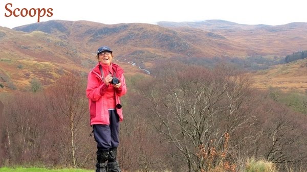


9
February 2013 – Knockman Wood & Garlies Castle Report by Richard Kay
Isobel,
Frances, Claire, Linda, Mary, David Pride, and Jimmy arrived at the turn off
into Knockman Wood just as Irene was opening the gates for Duncan and his other
passengers – thanks Irene! We drove on to the car park a bit further along the
forest road where we met the other walkers: Audrey, Forbes, Richard (leading),
Andrea (back-up), Robert, Rosie and a friend of hers, Margaret, Jim, John two
sticks, Christine Sloan, Hilary (not seen her for ages, now lives quite close
by the woods) and a visitor, Morag. I
phoned the Galloway Arms to let them know our numbers and estimated time of
arrival for refreshments.
Twenty-one ramblers assembled at the Forestry Commission
car park at Knockman wood near Minnigaff.
The weather was overcast with low cloud but the forecast hinted at
better things later in the day so they set off up the new forest road towards
the summit of Knockman Hill. As they
went they were distracted by a loud whistling noise; apparently a bird call.
None of the walkers could identify it.
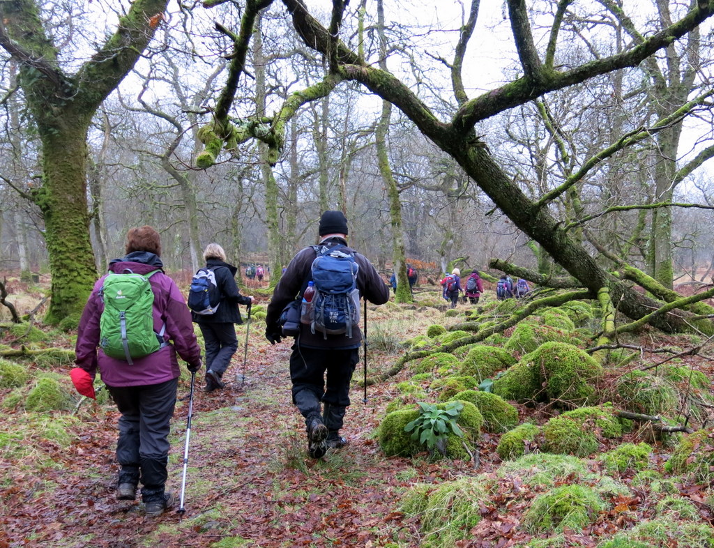
The road climbed through the coniferous woods and soon reached the old
deer park dyke which formed the boundary with the areas managed by the Cree
Valley Community Woodland Trust. Here
the conifers had been cleared and a mixture of older oak woods, new broadleaved
planting and open spaces provided a more open aspect.
The
weather was misty and it deteriorated through the day, turning to mizzle and
occasional drizzle but just kept off actually raining until the walk was
over. I struggled with the initial
uphill section but enjoyed being side-tracked by photographing fungus pointed
out to me by Jim and by the barren and sometimes dead trees. The mist hung everywhere which, of course,
added atmospherics to everything. The
walkers disappearing into the distant murk just gave me extra material instead
of spurring me on to catch up although I had to do some of that! However, with
the walk not being a long one, there was no hurry and most of the walkers were
glad of the excuse to stop on their way uphill to look at the information
provided on the plentiful boards provided through funding by SNH.
A newly repaired path led the group steadily
up the hill towards the Boreland Chambered Cairn. The group paused briefly to
examine the cairn and then continued to follow the rough track through the wood
pasture zone towards the summit of the hill.
Numerous information boards outlined the environmental interest in the
area. On the way up they met a small
group of walkers who were resting on their way back from the summit. They had intended to make a more strenuous
walk in the hills but had changed their plans because of the weather. The group then climbed onwards and upwards
into the mist. When they reached the
summit cairn they paused while the leader pointed out the fine views which were
available. Unfortunately none were
visible in the mist.
The ramblers then left the
prepared path and followed deer tracks down the hill while trying to avoid the
worst of the boggy ground. They soon
reached the lower path and turned northwards to continue to descend
gently. A deer fence which enclosed a regeneration
area followed the left side of the path.
At the lowest point of the fence the group again turned off the prepared
path and followed the deer fence until turned back up the hill. At this point the group could then see the
effect of an earlier deer fence where the growth of trees was abruptly cut off
at the old fence line.
I
thought of Shirley and Carol all day as I followed behind Andrea and we
reminisced over our day in August when we battled our way through the bracken,
tripping over rocks, going down hidden holes and with me trying to see my way
ahead (Andrea told the others she thought she had lost me a few times!). Today the bracken was down, wet and red,
slippery but easily negotiated after we left the solid path at the cairn. I marvelled at how we had actually managed at
all in some places where, even being able to see where we were putting our
feet, we had to negotiate our way over increasingly wet ground.
At this point the walkers
left the fence and followed the harder ground through groups of oak and alder
trees down to the old deer dyke; an impressive dry stone wall nearly 2 metres
high. An old gateway gave access onto
the open moor. The route crossed a small burn with the expert help of Richard and an
area of mixed rocky and boggy ground to reach the old track marked on the
maps. The line of the track was just
discernible over the grassy land and led to the site of an old ferm toun; a
collection of long abandoned ruins where once families would have scratched a
living from the unforgiving land. Beyond
the ruins the track led down to Garlies Wood which surrounds the castle.
On reaching the castle the
ramblers spread out among various perches to take their lunches. As they ate the rain began to drizzle from
the leaden skies but the trees and ruins provided adequate shelter. After lunch the group headed down through the
woods to the Peat Rigg Strand. This is a
substantial burn. Fortunately it was not
running too fiercely and the group crossed largely dry shod.
Before
long we were at the Peat Rig Strand burn and Richard assisted many of the
walkers in crossing it, positioning himself in the middle to give balance to
us. I just had time to get photos of the
waterfall just above where we had crossed before trying to catch up with the
others. I did so just as they had got to
the other side of a sliding wooden gate and Richard was making a pretence of
closing it ! I was actually shattered by
this time and was glad that the next section of the walk, whilst boggy, was
downhill!
The route then led up
through an attractive stand of oak trees to another gate in the deer dyke. They then emerged into open, if somewhat
soggy, grazing land and they followed the wheel tracks of a farm vehicle down
to the track in the valley. The track took
them past the Glenmalloch Schoolhouse.
The group wondered how a teacher had managed twenty-five girls in such a
small room.
Beyond the schoolhouse the track ran along the wall of
the Cumloden policy woods with its large trees and dense rhododendron. Near the end of the policies the group crossed
the moorland to reach the old track which leads back to the Pheasant Liggat in
Knockman Wood. A small diversion took
them to the top of Torbain, a low grassy hill with a Millennium cairn on its
summit. The group crossed the hill and
regained the track which they followed back to the cars. The somewhat damp ramblers then returned to
the Galloway Arms in Newton Stewart for tea and scones and a warm fire. They were pleased to meet another rambler who
is recovering from a broken leg but had made the effort to join them.
We
were delighted when we were joined by Gordon who had primed me not to let
anyone know that he might join us – he was not sure if it would happen and when
he had arrived so much later than us I thought it wasn’t going to! A pint of something alcoholic was his
preference as he was catching the bus back to Ayr! However, he was lucky to get an offer of a
lift home.
Next week’s event is a
moderate 8.5 mile walk along the coast from the Isle of Whithorn to
Garlieston. Meet at 09:00 at the
Breastworks Car Park, Stranraer or 09:30 at the Riverside Car Park in Newton
Stewart to share transport. The group
will start with a bus from Garlieston at 10:30 to the start of the walk. New walkers are always welcome but please
contact the walk leader on 01988 840268 to discuss the details.
1 comment:
lovely photos and commentary...thank you, Zoe
Post a Comment